


From Design to Data-Driven Decisions: The Seismic Surveying Lifecycle Explained
- Oceania Geo Seismic

- 24 hours ago
- 4 min read
Seismic surveying is a cornerstone of resource exploration in Australia. It provides critical insights into subsurface structures, enabling companies to make informed drilling and development decisions. But seismic data doesn't just appear - it’s the result of a highly coordinated process that balances technology, logistics, environmental responsibility, and precision.

At Oceania Geo Seismic, we specialise in efficient, low-impact seismic surveying across some of Australia’s most diverse and challenging terrain. Whether for hydrocarbons, coal, minerals, or other resources, our goal is to help clients get the most value from every seismic project - safely, sustainably, and cost-effectively.
Here’s a look at how a typical seismic project lifecycle unfolds with Oceania Geo Seismic, from early-stage design through to final data delivery and interpretation.
1. Feasibility & Planning: Tailoring Seismic to the Terrain
Every successful seismic survey begins with a clear understanding of the client’s exploration goals and the ground conditions. In this initial phase, we assess the geological objectives, site access, environmental restrictions, landholder concerns, and operational constraints. Australia’s vast and varied landscape, ranging from floodplains and farmland to rugged outback, demands customised planning. We help determine whether a 2D, 3D, or combined survey will provide the most value for the client’s investment, and we build a plan that suits both the exploration needs and the environment.
Good planning and communication are the foundation of efficient seismic acquisition.
2. Seismic Survey Design: Smart Layouts, Better Results

Survey design is more than just drawing lines on a map. It’s about balancing resolution, data quality, and cost, while respecting the physical and regulatory constraints of the site.
We use industry-leading software to model source and receiver geometries that meet the client’s imaging objectives. Our team considers terrain type, vegetation density, land use, and known environmental sensitivities to produce the most effective layout possible.
At Oceania Geo Seismic, we’re also committed to minimising ground disturbance. Our designs avoid sensitive habitats, cultural sites, or landholder infrastructure. The result? A smart, responsive survey design that maximises value and minimises impact.
We optimise every meter of line to deliver the clearest possible data with the smallest possible footprint.
3. Approvals, Permits & Environmental Stewardship
In Australia, seismic surveying is subject to rigorous environmental and land access regulations. At this stage of the lifecycle, we assist clients in securing all necessary permits and coordinating with relevant stakeholders, including Traditional Owners, government agencies, and private landholders.
We support:
Cultural heritage assessments
Environmental impact assessments
Stakeholder consultation
Risk mitigation planning
Because we specialise in low-impact seismic operations, Oceania Geo Seismic can often reduce the level of disturbance required, making it easier to gain approvals, especially in sensitive or protected regions.
Compliance isn’t just a box to tick - it’s part of our operational DNA.
4. Field Acquisition: High-Performance, Low-Footprint

Acquisition is the heart of any seismic project. It’s the point where the plan becomes reality and where Oceania Geo Seismic shines. Oceania Geo Seismic mobilises lean seismic crews, lightweight geophysical receivers, and scalable, cutting-edge seismic sources - designed specifically for minimal ground footprint and reliable data output.
Our crews are trained for efficiency and safety. By keeping our teams lean and agile, we reduce downtime, streamline logistics, and maintain flexibility in the face of weather or terrain challenges.
We also implement real-time quality control (QC) and field reporting, allowing us to monitor data integrity as it’s collected and make adjustments instantly if needed.
It’s not just about collecting data - it’s about collecting the right data, efficiently.
5. Data Processing & Final Delivery: Insight You Can Trust
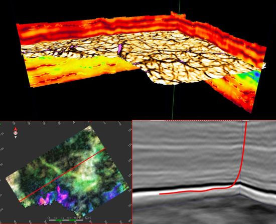
Once field operations are complete, the raw seismic data enters the processing phase. This is where noise is removed, signals are enhanced, and images of the subsurface are generated.
While we don’t currently process data in-house, we work closely with trusted geophysical processing partners (or the client’s chosen provider), to ensure a seamless handover. We provide clean, organised data sets alongside comprehensive field notes, QC summaries, and metadata.
Our team ensures the client's geophysicists or interpreters receive everything they need, fast and in the right format.
From day one, we design the survey with the end data product in mind.
6. Data-Driven Decisions: Turning Seismic Insights into Action
The ultimate goal of seismic surveying isn’t just to generate data - it’s to de-risk and empower smart, confident decision-making. Once seismic data has been processed, it becomes a powerful tool for interpretation and modelling. Exploration teams use this information to pinpoint drill targets, map geological structures, and reduce financial and operational risk.
At Oceania Geo Seismic, we don’t just focus on how data is collected; we focus on how it will be used. By tailoring every phase of the seismic acquisition lifecycle to your exploration objectives, we help ensure the final data is as actionable as it is accurate.
Whether you’re:
Selecting the next drill location
Reducing uncertainty around a coal seam
Planning infrastructure around fault lines
...high-quality seismic data gives you a competitive edge.
We work closely with your geophysicists and decision-makers to understand the outcomes you need, and ensure our acquisition strategy supports those goals from the very start.
From energy delivery in the field to insight delivery in the boardroom, data is only valuable if it drives the right decisions.
Why Oceania Geo Seismic?
Seismic surveying in Australia demands more than just equipment - it requires experience, local knowledge, and a genuine commitment to safe and sustainable practices. At Oceania Geo Seismic, we bring all three.
Here’s what sets us apart:
Tailored seismic solutions – designed around your geology, goals, and site constraints
Low-impact operations – using lightweight, modern equipment with minimal disturbance
Lean, expert crews – delivering high-quality outcomes efficiently and cost-effectively
Strong HSE culture – prioritising safety, compliance, and community engagement
Whether your project is in Queensland’s coal country, a remote mineral tenement in Western Australia, or somewhere in between, Oceania Geo Seismic is ready to deliver seismic surveying solutions that are fit for purpose and built for value.
From design to data, we’ve got seismic covered.
Let’s Talk Seismic
Planning a seismic surveying project? Need a fresh approach to seismic acquisition in Australia? Oceania Geo Seismic is ready to help.
Contact us today to discuss your goals and discover how we can support your next project from initial concept to final data delivery.